Click on images below to enlarge:
|
 |
|
|
|
|
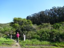
| Di Yin near the beginning of our hike. Notice the tall trees in the
background-right.
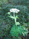
| I knew from the trail guide that there were elderberry plants on the
route. Di Yin guessed (as it turns out, correctly) that this was one.
| A close-up of the elderberry flowers.
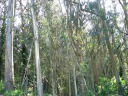
| A eucalyptus grove.
|
|
|
|
|
|
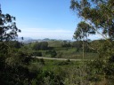
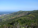
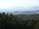
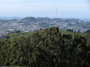
| As we climbed, we got glimpses across the park.
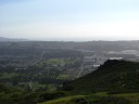
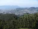
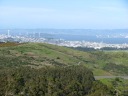
| In this high-resolution photo looking east from the park, one sees the
curve of the Candlestick Park stadium, the bay, and the east bay. I
don't know what that large crane is.
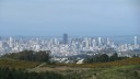
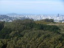
| A high-resolution shot of downtown San Francisco.
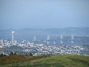
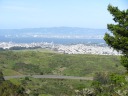
| Using an 8x zoom, one can see the bay bridge leading to Yerba Buena
Island / Treasure Island, with the Berkeley hills in the background.
|
|
|
|
|
|
| On the south side of the park, a strange series of layers of exposed
rock.
| A panoramic movie looking south through north-east from one of the
park's ridgelines. Listen with sound to hear my entertaining
commentary.
Yes, it was incredibly windy!
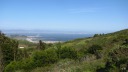
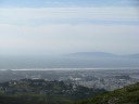
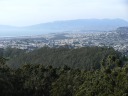
| Looking west from the park across the town of Colma toward the
(washed-out) Pacific Ocean. All those green spaces in Colma are
cemeteries. Colma is pretty much the only town in the peninsula with
cemeteries, and it has a lot of them!
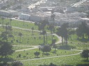
| A close-up of one of Colma's cemeteries. (I took this picture because I
was unsure that those green spaces actually were cemeteries as opposed to
something else that requires green space.) No, I don't know why many
headstones are dark. (That's what made me question my original theory
about cemeteries.)
|
|
|
|
|
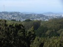
| Looking north-west from the park, one can see the sandy beaches along
San Francisco's Richmond and Sunset districts. In the distance are the
Marin headlands (the north bay).
| A wide panorama, stretching from west (the Pacific Ocean) to north-west
(the Marin headlands), north (the many hills of San Francisco),
north-east (downtown San Francisco's skyscrapers then the bay bridge) to
east-north-east (the east bay). This photo gives a good sense of the
park, which is shown spanning the foreground.
| At one point, the trail we were on disappeared into overgrown bushes.
Fear not: the trails we hiked were always easy to follow except for this
short (20 foot) segment of Dairy Ravine trail.
|
|
| Fodder for Huge Panorama
|
|
|
|
|
| | | |
|
|
|
|
|
| | | |
|
|
|