Click on images below to enlarge:
|
 |
|
|
|
|
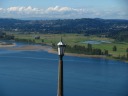
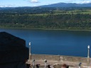
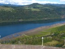
| A streetlamp seen against the background of the other side of the
Columbia River.
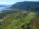
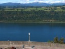
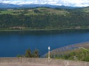
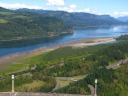
| A picture focused on the flatlands next to the river.
The road by
the way is interstate 30.
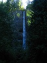
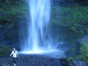
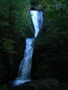
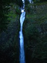
| The first waterfall we stopped by, Latourell Falls.
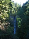
| Another shot of Latourell Falls.
|
|
|
|
|
|
| Someone playing at the bottom.
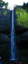
| A stitched panoramic photo showing the height of Latourell Falls.
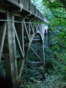
| I like the texture of the wood arches and trusses supporting this bridge
on the Historic Columbia River Highway. Excellent.
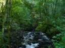
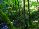
| A vibrant green scene and stream on the way to Bridal Veil Falls.
|
|
|
|
|
|
| Bridal Veil Falls.
| Looking back down the trail leading to Bridal Veil Falls. (The stream
is the fall run-off.) Excellent for the color of the moss
blanketing the trees.
| Wahkeena Falls. If you look closely, you can see the bridge in the
middle of the photograph close to the falls. We decided we didn't have
time to hike up there, so I took this picture of the falls from near the
parking area.
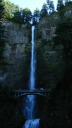
| Multnomah Falls, the second-highest year-round-water-flow waterfall in
the United States.
|
|
|
|
|
|
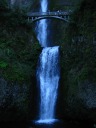
A higher-resolution shot of Multnomah Falls. The falls have two
segments. The overlook bridge is about a fifth of the way up the upper
segment, which is by the far the largest one.
I believe I climbed
to the overlook bridge when I visited in 2002, so I didn't feel the need
to do so this time.
| The lower segment of Multnomah Falls.
| Horsetail Falls.
|
We detoured quickly through the Bonneville Dam complex, but didn't pause
to take pictures. I don't regret skipping the pictures; it wasn't
particularly photogenic.
|
|
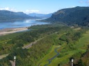
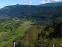
| Fodder for Columbia River Gorge Panorama
|
|
|
|
|
| | | |
|
|
|
|
| | |
|
| Fodder for Latourell Falls Panorama
|
|
|
| |