Up to Boston and New England (again) - February 13th-22nd 2009

Top

February 17th 2009: Boston Harbor Walk

Having forgotten my regular camera, I took these pictures with my cell phone camera.


Page 1 of 1.
Click on images below to enlarge:
A model of Boston (right) and South Boston (left).  I explored these
bridges and the area surrounding them. 

The Boston section of this model only includes the financial district.


In this photograph, up is roughly south-west.
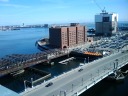
The view facing northeast from a rooftop in Boston toward the north end
of South Boston.
Looking southwest down the inlet, there's more of South Boston on the
left, and two more bridges crossing the Fort Point Channel.
Downtown Boston as seen from the Seaport Blvd bridge.
A model of Boston (right) and South Boston (left). I explored these bridges and the area surrounding them.
The Boston section of this model only includes the financial district.
In this photograph, up is roughly south-west.
The view facing northeast from a rooftop in Boston toward the north end of South Boston.
Looking southwest down the inlet, there's more of South Boston on the left, and two more bridges crossing the Fort Point Channel.
Downtown Boston as seen from the Seaport Blvd bridge.
A sample of South Boston's bridge buildings.  These were better maintained
than most.
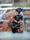
This was the first time I've seen lobster meat sold separately depending
on which part of the lobster it came from.  This was at the James Hook & Co
Shell Fish store.
A sample of South Boston's bridge buildings. These were better maintained than most.
This was the first time I've seen lobster meat sold separately depending on which part of the lobster it came from. This was at the James Hook & Co Shell Fish store.